
Strong Storms Erupt Across The Northern Plains
Strong to severe thunderstorms will form across the northern Plains once again this afternoon and evening leading to travel delays.
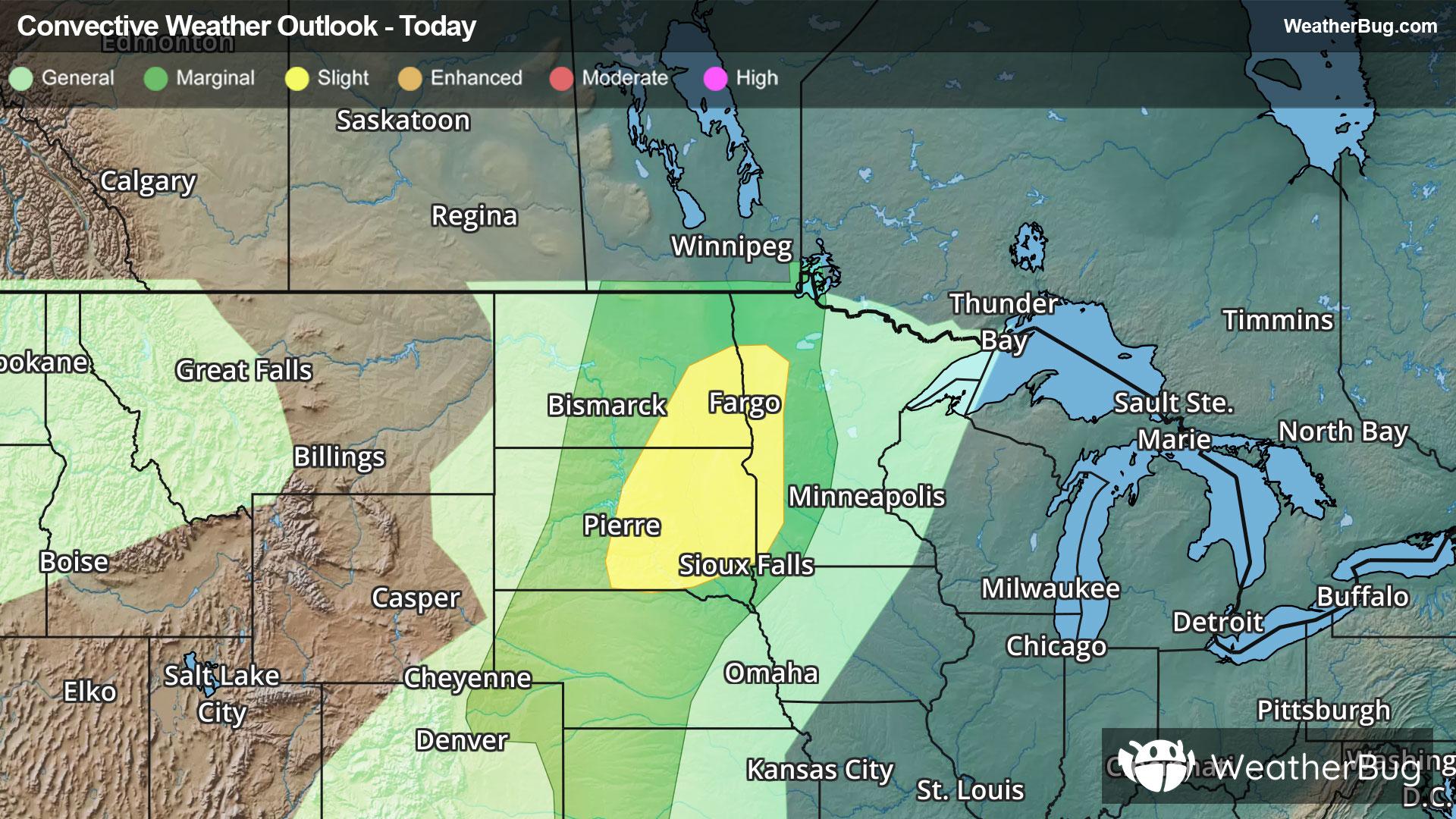
A disturbance will move across southern Canada and the northern Plains today causing strong to severe thunderstorms this afternoon and evening across parts of eastern North Dakota, eastern South Dakota and into far western Minnesota. Main risks from these thunderstorms will be strong wind gusts up to 60 to 70 mph, hail and even a couple of tornadoes.
A Slight Risk, or a 2 out of 5 on the severe weather probability scale, has been issued by the government's Storm Prediction Center for parts of southeastern North Dakota, eastern South Dakota and far western Minnesota. This threat area includes Fargo, N.D., and Pierre, S.D.
Make sure to know the difference between a watch and a warning should they be issued. A "watch" means that conditions are favorable for severe weather to occur, and to be on alert for any rapidly changing conditions. A "warning" means that severe weather is imminent, and you should act fast to remain safe.
The best way to remain safe is to stay prepared and informed about your local weather. Have a severe weather kit packed with a battery-operated radio, water, and non-perishable food items. Also, check the WeatherBug app frequently for any updates on today's severe weather. Remember, "When Thunder Roars, Go Indoors!"